Zealandia: The Long-Lost Continent Rediscovered
The discovery and confirmation of the submerged continent Zealandia represent a monumental breakthrough in geology. Long theorized but only officially recognized in 2017, Zealandia offers a unique window into Earth’s geological history, plate tectonics, and the evolution of supercontinents. Below is a detailed exploration of this fascinating hidden landmass, its historical and geological significance, and the implications of its discovery.
1. Introduction to Zealandia
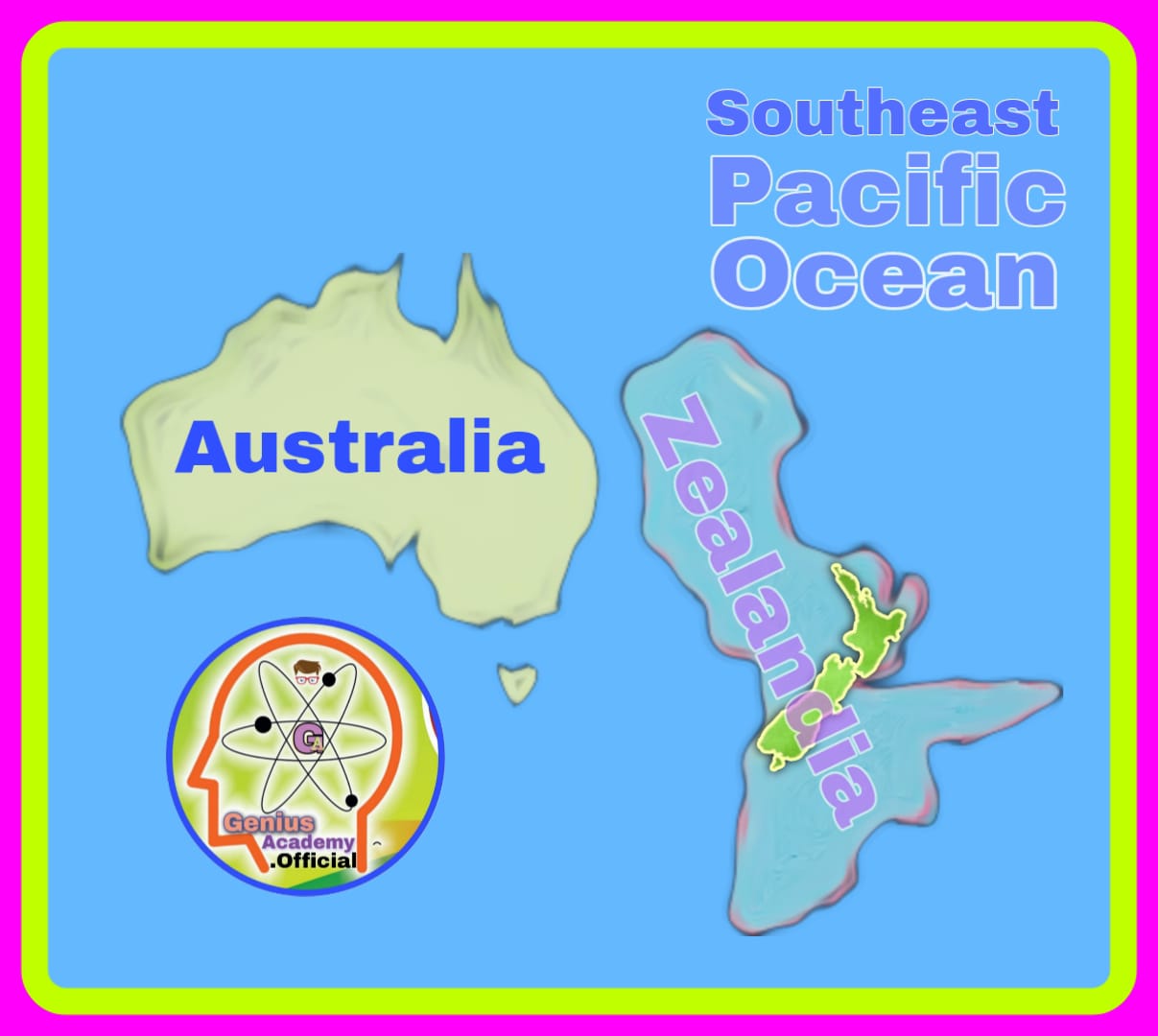
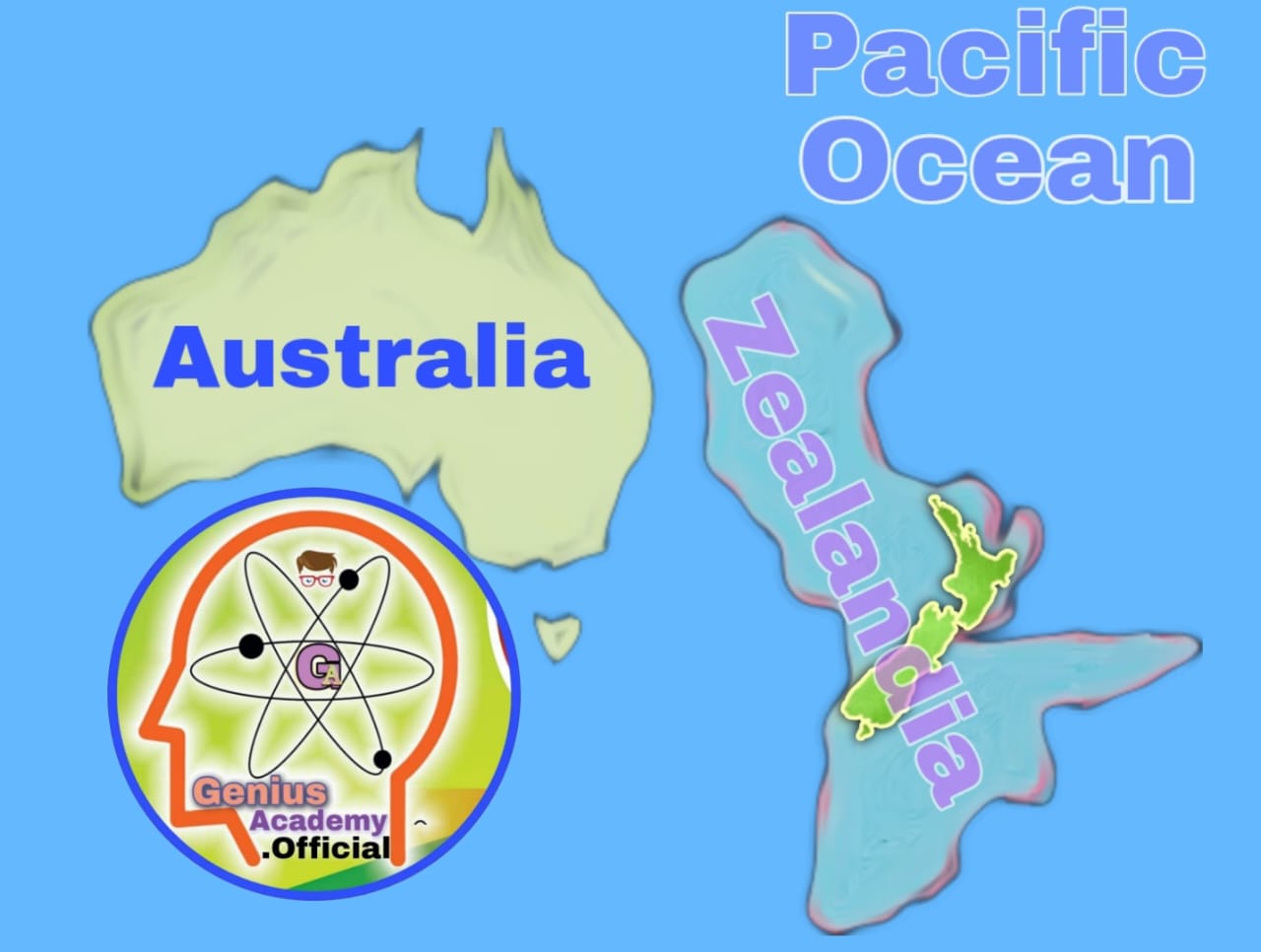
Zealandia, or Te Riu-a-Māui in the Māori language, is a narrow microcontinent located predominantly beneath the South Pacific Ocean. It spans an area of approximately 4.9 million square kilometers (1.89 million square miles), about half the size of Australia. Despite its vast size, only about 6% of Zealandia’s surface is above water, comprising New Zealand, New Caledonia, and a few other small islands. The rest lies submerged under the ocean, making it a unique case of a nearly completely underwater continent.
2. The Journey of Discovery
2.1 Early Observations
The existence of Zealandia was first hinted at in 1642 by Dutch explorer Abel Tasman, who sought the mythical Terra Australis or the “great Southern Continent.” Tasman’s expeditions recorded observations of the land now recognized as part of Zealandia, but the concept of a distinct continent remained speculative.
2.2 Formal Recognition as a Continent
It was not until 2017 that Zealandia was officially recognized as Earth’s seventh continent. Advances in seafloor mapping and rock sampling provided compelling evidence of its continental crust and distinct geological features, distinguishing it from the surrounding oceanic crust.
2.3 Key Evidence
Geologists established Zealandia’s status as a continent based on four criteria:
- Elevation: Despite being underwater, Zealandia’s crust is significantly elevated compared to the ocean floor.
- Distinct Geology: The region’s rocks include continental types such as granite, which are absent in oceanic crust.
- Crust Thickness: Zealandia’s crust is much thicker than typical oceanic crust, averaging 20–30 kilometers compared to 7 kilometers.
- Clearly Defined Boundaries: Zealandia is separated from Australia and other landmasses by well-defined geological boundaries.
3. About Zealandia
3.1 Location and Composition
Zealandia lies to the east of Australia and south of New Caledonia. Its visible landmass includes:
- New Zealand’s North and South Islands
- New Caledonia
- Smaller islands such as Norfolk and Lord Howe.
The submerged portion extends over a vast area, with an average depth of about 2 kilometers (6,560 feet) below sea level.
3.2 Geological Features
- Diverse Rock Formations: Zealandia’s crust contains granite, schist, and sedimentary rocks typical of continental regions.
- Mountain Ranges and Basins: The visible portions, such as New Zealand’s Southern Alps, offer a glimpse into the region’s dynamic geological processes.
4. Formation and Geological History
4.1 Part of Gondwana
Zealandia was once part of the ancient supercontinent Gondwana, which included present-day Africa, South America, Antarctica, India, and Australia. About 105 million years ago, tectonic forces caused Zealandia to begin breaking away from Gondwana.
4.2 Submersion
As Zealandia drifted eastward, it underwent significant thinning of its crust. Approximately 94% of the landmass became submerged underwater, leaving only a small fraction visible today. This process is attributed to tectonic stretching and subsidence over millions of years.
4.3 Modern Dimensions
Zealandia spans an area roughly half the size of Australia, making it a massive geological structure. Its submerged status highlights the diverse processes that shape continents and ocean floors.
5. Tectonic Plate Boundaries and Activity
Zealandia rests on the boundary of multiple tectonic plates, making it a region of considerable geological activity.
5.1 Major Plate Interactions
- Pacific Plate and Indo-Australian Plate: Zealandia is split between these two plates. The southern part lies on the Pacific Plate, while the northern part lies on the Indo-Australian Plate.
- Alpine Fault: This major fault line runs through New Zealand, accommodating a displacement of about 500 kilometers. It represents the active boundary between the Pacific and Indo-Australian Plates.
5.2 Geological Impacts
- Earthquakes: The tectonic activity in the region makes it highly prone to earthquakes.
- Mountain Building: Interactions between plates have led to the uplift of mountain ranges, such as New Zealand’s Southern Alps.
- Volcanism: The region also experiences volcanic activity due to tectonic processes.
6. Scientific Significance of Zealandia
The discovery of Zealandia has profound implications for various fields of study:
6.1 Plate Tectonics
Zealandia provides a natural laboratory for understanding plate tectonics. The region illustrates how continents can fragment and submerge, offering insights into the dynamics of Earth’s crust.
6.2 Geological History
The study of Zealandia’s rocks and sediments helps reconstruct the history of Gondwana and the processes that led to its breakup.
6.3 Biodiversity and Ecosystems
Zealandia’s isolation and unique geological history have shaped the biodiversity of its visible regions, such as New Zealand. The study of endemic species provides clues about evolutionary processes.
6.4 Resource Exploration
The submerged continent holds potential for natural resources, including minerals and hydrocarbons. However, exploration is constrained by environmental and logistical challenges.
7. Challenges in Studying Zealandia
7.1 Accessibility
The vast majority of Zealandia lies underwater, making exploration and study expensive and technologically challenging.
7.2 Data Collection
Collecting seafloor samples and mapping the underwater terrain require advanced equipment and expertise.
7.3 Environmental Concerns
Exploration of Zealandia raises environmental concerns, particularly regarding the impact on marine ecosystems.
8. Comparison with Other Continents
Zealandia’s status as a continent is unique due to its submerged nature. In contrast to traditional continents like Asia or Africa, Zealandia challenges conventional definitions of a continent, expanding our understanding of geological classifications.
| Aspect | Zealandia | Traditional Continents |
|---|---|---|
| Visibility | 94% submerged | Entirely above water |
| Size | Half the size of Australia | Varies (e.g., Asia is largest) |
| Geological Traits | Distinct continental crust | Similar continental crust |
9. Broader Implications of Zealandia’s Discovery
9.1 Redefining Geological Paradigms
The recognition of Zealandia as a continent has expanded scientific understanding of Earth’s geology, highlighting the complexity of continental formation and evolution.
9.2 Global Plate Tectonics
Zealandia plays a critical role in global tectonic processes. Its study helps refine models of plate movements and interactions.
9.3 Education and Awareness
The discovery of Zealandia has sparked global interest in Earth sciences, encouraging further research and public engagement.
10. Concluding Remarks
Zealandia’s recognition as the “eighth continent” marks a significant milestone in geology. Its submerged nature and unique geological history challenge traditional definitions of continents while offering a treasure trove of scientific insights. From its origins in Gondwana to its current role in global tectonic processes, Zealandia is a testament to the dynamic and ever-changing nature of our planet.
As research continues, Zealandia promises to deepen our understanding of Earth’s past and present, shedding light on the intricate forces that shape our world. Its story underscores the importance of exploration and scientific inquiry in uncovering the hidden wonders of our planet.
UPSC (CSE) Mains Questions on Zealandia
Geography and Geology (GS Paper I)
| [Q1.] Discuss the geological history of Zealandia and its significance in understanding the breakup of Gondwana. (250 words) |
| [Q2.] What makes Zealandia a unique geological entity? Critically analyze its recognition as Earth’s ‘eighth continent’. (250 words) |
| [Q3.] Examine the role of tectonic plate interactions in shaping the geological features of Zealandia. Highlight the significance of the Alpine Fault in this context. (250 words) |
| [Q4.] Zealandia remains 94% submerged underwater, yet it qualifies as a continent. Explain the criteria used for its classification as a continent. (250 words) |
| [Q5.] Compare and contrast Zealandia with other continents in terms of geological structure, size, and visibility. What challenges does its study pose for geologists. (250 words) |
Environmental and Resource Management (GS Paper III)
| [Q6.] Assess the environmental and logistical challenges associated with exploring the submerged continent of Zealandia. Suggest measures to mitigate these challenges. (250 words) |
| [Q7.] How does the biodiversity of Zealandia’s visible landmass, such as New Zealand, reflect its unique geological history? (250 words) |
FAQs on Zealandia for UPSC Preparation
1. What is Zealandia?
Answer:—
Zealandia is a submerged continent located in the South Pacific Ocean, east of Australia and south of New Caledonia. It spans 4.9 million square kilometers, with only 6% of its area above sea level, including New Zealand and New Caledonia.
2. Why is Zealandia considered a continent?
Answer:—
Zealandia meets the four criteria for continental classification:
- Elevation: Elevated above the surrounding ocean floor.
- Distinct Geology: Contains continental crust materials like granite.
- Crust Thickness: Thicker than oceanic crust (20–30 km vs. 7 km).
- Clearly Defined Boundaries: Separated from neighboring landmasses.
3. What is the historical significance of Zealandia?
Answer:—
Zealandia was part of the ancient supercontinent Gondwana. Its study helps geologists understand the processes behind Gondwana’s breakup and the tectonic forces shaping Earth’s continents.
4. When was Zealandia officially recognized as a continent?
Answer:—
Zealandia was formally recognized as a continent in 2017, based on extensive geological studies, seafloor mapping, and rock sample analyses.
5. What are the visible parts of Zealandia?
Answer:—
The visible portions of Zealandia include New Zealand’s North and South Islands, New Caledonia, and some smaller islands like Norfolk Island.
6. How did Zealandia form?
Answer:—
Zealandia began separating from Gondwana about 105 million years ago due to tectonic forces. Crustal thinning and subsidence over millions of years caused 94% of it to submerge underwater.
7. What is the significance of the Alpine Fault in Zealandia?
Answer:—
The Alpine Fault, located in New Zealand, marks the boundary between the Pacific Plate and the Indo-Australian Plate. It is a site of significant tectonic activity, including earthquakes and mountain formation.
8. What are the challenges in studying Zealandia?
Answer:—
- Submerged Nature: Most of Zealandia lies 2 km below sea level.
- Accessibility: High costs and advanced technology are required for exploration.
- Environmental Concerns: Potential harm to marine ecosystems.
9. Why is the study of Zealandia important?
Answer:—
Studying Zealandia provides insights into:
- The dynamics of plate tectonics.
- The geological history of Gondwana.
- Biodiversity evolution in isolated ecosystems.
10. Does Zealandia have resource potential?
Answer:—
Zealandia may contain valuable resources such as minerals and hydrocarbons. However, exploring and extracting these resources involves significant ethical and environmental considerations.
11. How does Zealandia differ from other continents?
Answer:—
Unlike traditional continents, Zealandia is 94% submerged. It is half the size of Australia, with distinct geological traits and a thick continental crust.
12. How does Zealandia contribute to global tectonic studies?
Answer:—
Zealandia’s unique features and tectonic plate interactions make it a natural laboratory for studying continental breakup, plate movements, and crustal processes.
_

